Old Farm Hill Park topo map
Originally uploaded by Kathryn Cramer.
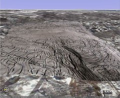
Topo map of Old Farm Hill Park, an undeveloped park in my neigherborhood, superimposed on the Google Earth satellie view. Terrain setting is 2, so I could see if the countours of the land approximated the contours of GE's terrain.
Interestingly, from this angle, the street isn't quite matching as well as the contours are.
No comments:
Post a Comment