Mississippi River Flooding (NASA, International Space Station, 05/12/11)
Originally uploaded by NASA's Marshall Space Flight Center.
Via Flickr:
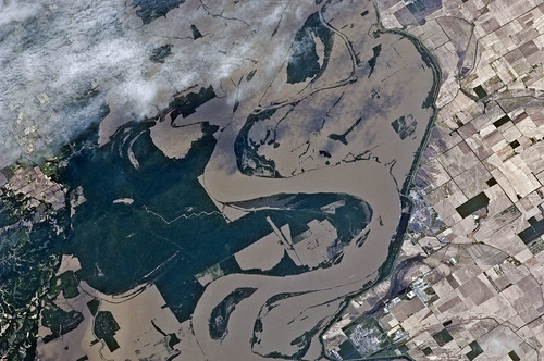
Parts of two states highly impacted by recent flooding of the Mississippi River, are pictured in this International Space Station image featuring an area east of Blytheville, Ark., off the right side of the image. Center point coordinates are located at 35.8 degrees north latitude and 89.7 degrees west longitude The areas of Ruckers Place, Tenn. and Tomato, Ark. are surrounded by water, while Barfield, Ark. is still dry behind the levee on the right side of the image. North is toward the bottom of the photo.
Image credit: NASA
Original image:
spaceflight.nasa.gov/gallery/images/station/crew-27/html/...
More about space station research:
www.nasa.gov/mission_pages/station/research/index.html
There's a Flickr group about Space Station Research. Please feel welcome to join! www.flickr.com/groups/stationscience/