GIScorps Hurricane Katrina Maps - Mississippi
GISuser.com posted a photo:
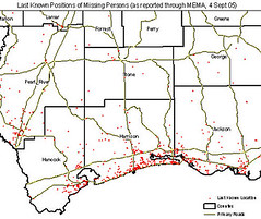
Map of last know position of missing persons generated for FEMA. Read on for a look at the response, some Q & A's, and example maps and images from the GIScorps in Mississippi. See this feature at GISuser.com - www.gisuser.com/content/view/6945/28/
Sent from NewsGator Online.
No comments:
Post a Comment